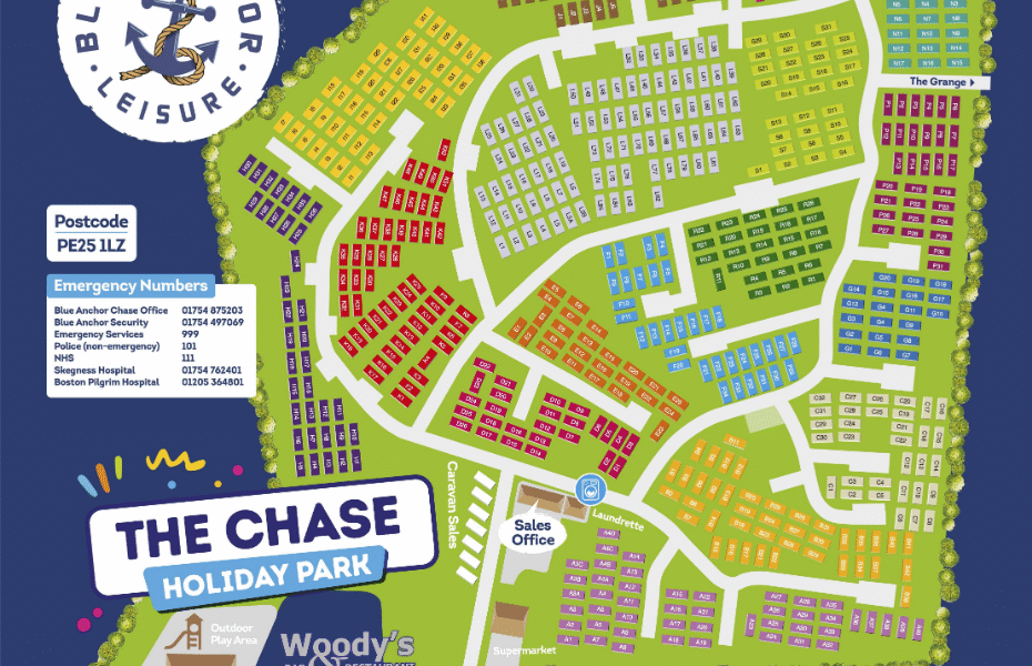
The Chase Caravan Park Google Map
Google Maps offers an incredibly useful tool for exploring Chase Caravan Park. Its satellite imagery provides a clear overhead view, allowing potential visitors to see the park’s layout, caravan pitches, and proximity to facilities like Woody’s Bar, the supermarket, and play areas before they even arrive. Street View, where available, can offer a virtual walk-through of the surrounding area, showcasing the short distance to Vickers Point with its entertainment and the sandy Ingoldmells beach. Users can also leverage Google Maps for real-time traffic updates when planning their journey to the park and for discovering local attractions nearby.