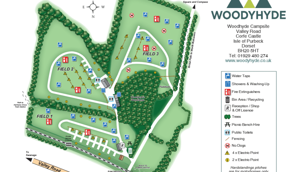
Woodyhyde Campsite Map
Holiday Park Maps Maps

Woodyhyde Campsite Map

Woodyhyde Campsite Map displays a well-planned layout with a variety of facilities designed for a peaceful and convenient camping experience. Water taps are spread across the site for easy access, and picnic bench hire is available for those wanting to enjoy meals outdoors. The site is securely fenced and maintains a no dogs policy, ensuring a safe and quiet environment. For campers requiring electricity, there are four electric points and an additional two, catering to various needs. Hardstanding pitches are provided exclusively for motorhomes, offering firm and level surfaces.

Adding to its unique character, the campsite is bordered by a private railway crossing, creating a charming rural setting. Fire extinguishers are located throughout for safety. Guests can visit the reception and shop, which includes an off licence for supplies. A well-maintained bin and recycling area supports eco-friendly practices, while clean public toilets ensure comfort during your stay.


Woodyhyde Campsite Google Map

Woodyhyde Campsite is easily found on Google Maps, offering a clear view of its scenic location in the heart of the Purbeck countryside. Users can explore the site using satellite view, standard map view, and immersive Street View for detailed navigation. These options help visitors plan their stay by previewing key features like the railway crossing, hardstanding motorhome pitches, and surrounding natural beauty, making it a perfect base for outdoor adventures.