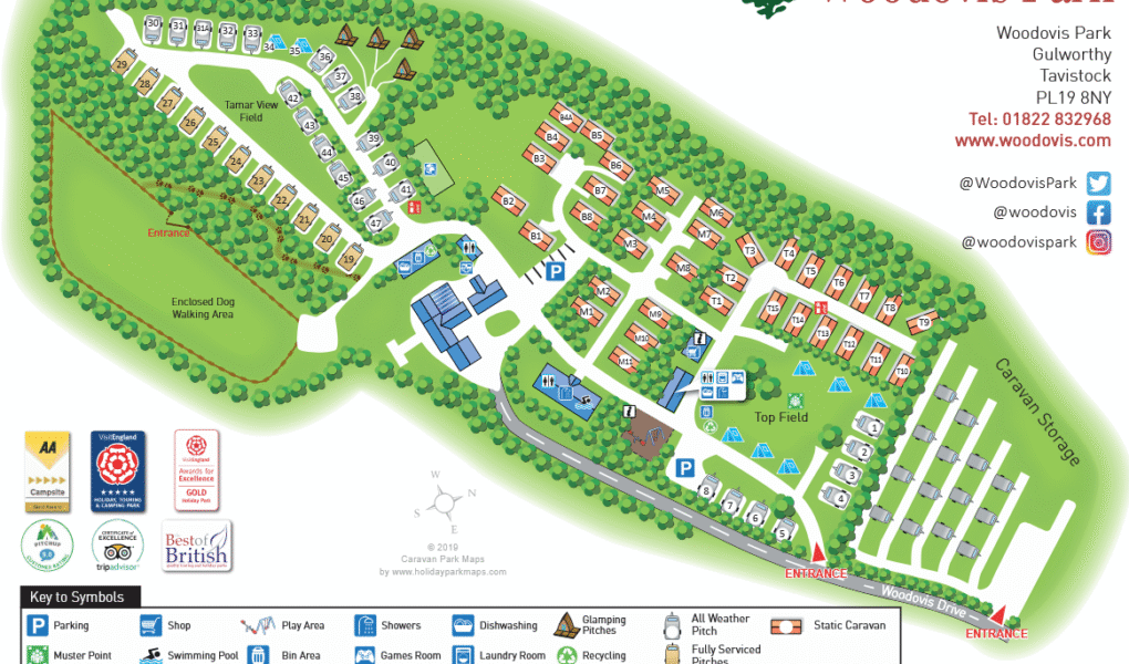
Woodovis Park map highlights all the key facilities designed for a comfortable and enjoyable stay. The Info/Reception area welcomes guests and provides essential information, while the onsite shop offers convenient access to groceries and holiday essentials. Visitors can unwind in the indoor swimming pool or have fun in the games room, perfect for families and groups. Clean and modern shower blocks are located nearby, ensuring guest comfort throughout their stay.
Safety features are clearly marked on the map, including Muster Points and Fire Extinguishers strategically placed around the park. Accommodation options range from cozy glamping pods to spacious pitches, catering to different preferences. The well-planned layout makes it easy to navigate between facilities, helping guests make the most of their time at Woodovis Park for a relaxing and hassle-free holiday.
Woodovis Park Google Map
Woodovis Park’s location on Google Maps provides a clear and convenient way for visitors to find and explore the park before arrival. Nestled in the beautiful Devon countryside near Tavistock, the map shows the peaceful surroundings and nearby points of interest, including Dartmoor National Park. Satellite and street views offer a close-up look at the site’s layout, including pitches, glamping areas, and amenities. With accurate directions and visual guidance, planning your journey to Woodovis Park is simple and stress-free.