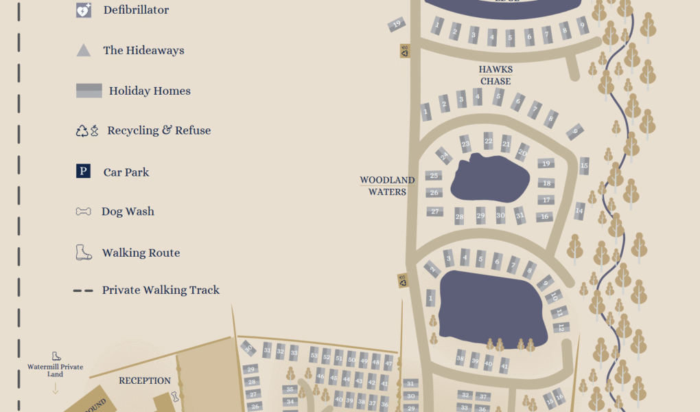
The Watermill Leisure Park Map provides a clear overview of this peaceful holiday retreat, highlighting essential amenities and thoughtfully designed areas. Upon arrival, guests are directed to the Reception and adjacent Car Park, ensuring a smooth check-in process. The map showcases both The Hideaways and permanent Holiday Homes, set in beautifully landscaped surroundings with easy access to the central fishing lake, a serene spot popular with anglers. A conveniently placed Defibrillator offers added peace of mind, while the Showground hosts seasonal events and gatherings.
Eco-conscious features such as the Recycling & Refuse points are clearly marked. Dog owners benefit from a dedicated Dog Wash facility, perfect after walks along the park’s scenic Walking Route and Private Walking Track, both highlighted on the map. These routes meander through nature-rich areas, offering a tranquil escape for walkers and wildlife enthusiasts alike.
Watermill Leisure Park Google Map
On Google Maps, Watermill Leisure Park is viewable in Satellite, Standard, and Street View formats. The Satellite view reveals the park’s lush greenery, fishing lake, and layout of lodges and facilities. In Standard view, users can easily identify roads, reception, and walking routes. Street View allows for a virtual stroll past holiday homes, the showground, and entrance, offering a clear sense of the park’s peaceful atmosphere and well-maintained surroundings.