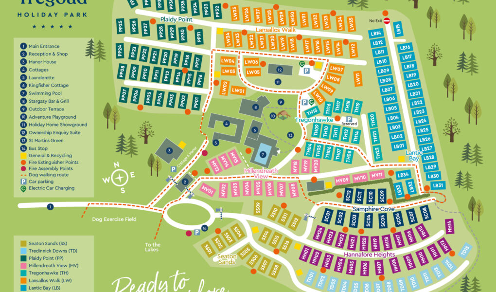
Tregoad Holiday Park Map
Holiday Park Maps Maps

Tregoad Holiday Park Map

Tregoad Holiday Park’s map provides a clear and detailed layout of the scenic 55-acre park, nestled in Cornwall’s countryside near Looe. The map highlights various accommodation options, including stylish lodges, cosy cottages, and the elegant Manor House. All are positioned within walking distance of the park’s main facilities, making it easy for guests to find their way around. Key amenities such as the indoor heated pool, Stargazy Bar & Grill, sauna, steam room, and children’s soft play area are centrally located and clearly marked for convenience.

The map also features tranquil walking routes that wind through woodland areas and around peaceful wildlife lakes, ideal for guests seeking a relaxing outdoor experience. It includes useful markers for parking, reception, the shop, and the secure entrance gate along the B3253. Overall, the map is an essential companion for navigating the park and making the most of all that Tregoad has to offer.


Tregoad Holiday Park Google Map

Tregoad Holiday Park’s location on Google Maps offers a convenient way to explore its layout and stunning surroundings. Situated near Looe in Cornwall, the park is clearly marked, with nearby attractions, roads, and walking routes easily visible. Satellite and street views allow visitors to preview the scenic countryside, coastal views, and park entrance. It’s especially helpful for planning travel routes and understanding proximity to local landmarks. Google Maps also displays guest reviews, photos, and directions, making trip planning simple and informative.