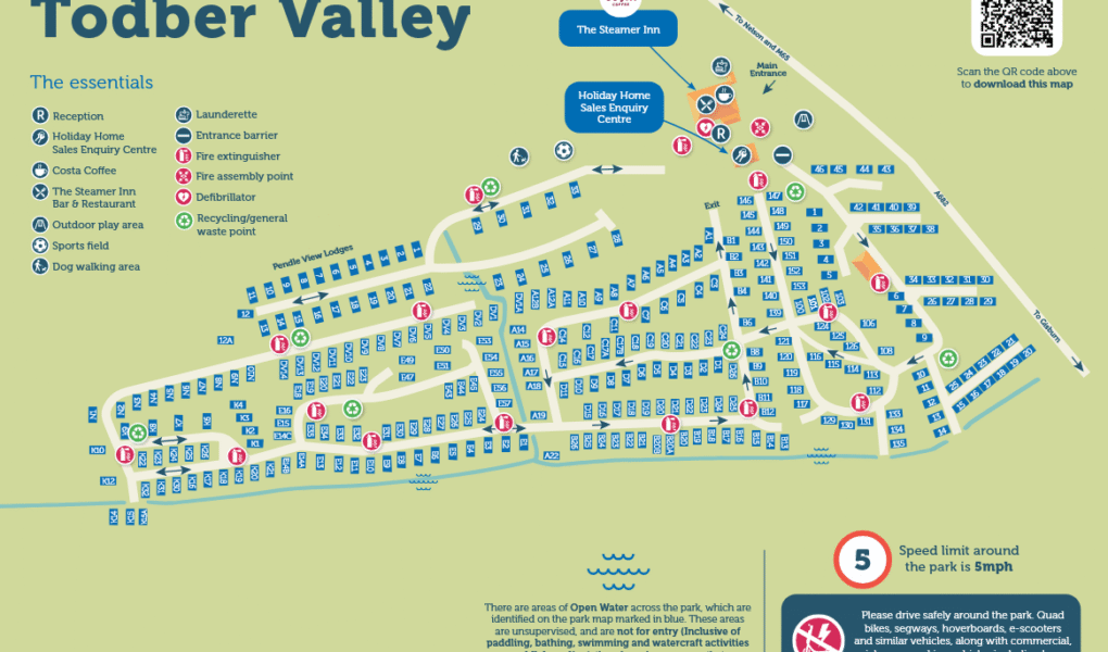
Todber Valley Holiday Park Map
Holiday Park Maps Maps

Todber Valley Holiday Park Map

🏞️ Exploring Parkdean Resorts Todber Valley

The Todber Valley Holiday Park map is your primary navigator for this tranquil countryside resort, perfectly positioned on the border of the Ribble Valley and the Yorkshire Dales. The layout helps you navigate the park’s elevated terrain, making it easy to locate your holiday home while taking in panoramic views of Pendle Hill.

Use the map to find central park hubs like The Steamer Inn bar and restaurant, the large outdoor beer garden, and the main entertainment venue. It also points you directly to daytime refreshments at the Costa Coffee station, the outdoor adventure playground, and the open recreation field.

The layout clearly marks out different accommodation zones, distinguishing between premium lodge sectors, caravan avenues, and dedicated touring fields. Essential amenities, including the park reception, convenience store, launderette, and dedicated dog-walking paths, are completely mapped for a stress-free rural escape.

Verified Map
Current Version:

πŸ—ΊοΈ How to Navigate the Interactive Map

πŸ›°οΈ

Toggle Map Views: Switch to Satellite View to pinpoint individual countryside caravans and luxury lodge locations across the valley tiers, or use the Standard Map for a simplified layout of holiday home rows, parking spaces, and rural pathways.

🚢

Explore Street View: Drop onto the park avenues to preview the elevated landscape around the main reception, the outdoor adventure playground, and The Steamer Inn complex, ensuring a familiar route through the resort layout on arrival.

Interactive Map