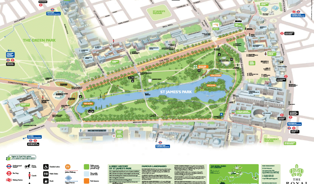
St James’s Park in London offers a detailed map to help visitors explore its beautiful landscapes and key features. The map highlights essential amenities such as disabled toilets and public toilets, ensuring accessibility and comfort for all visitors. Families can locate the children’s play area, ideal for younger guests to enjoy safely. The map also points out the park’s kiosks for snacks and refreshments, as well as a popular restaurant offering scenic views.
A notable landmark on the map is Duck Island, home to various bird species and a peaceful retreat within the park. Nearby, the Swire Fountain adds a tranquil touch with its elegant water feature. Whether planning a walk, picnic, or sightseeing trip, the St James’s Park map is an essential guide to enjoying everything this historic royal park has to offer.
Google Map
St James’s Park on Google Maps offers satellite, standard, and street views to help visitors explore this iconic London park. The satellite view provides a detailed aerial perspective of the park’s lush greenery and surrounding landmarks. The standard map clearly shows pathways, entrances, and key points like the lake, playground, and cafés. Meanwhile, street view lets users virtually walk through the park’s scenic routes and nearby streets. Together, these views make Google Maps an excellent tool for planning your visit to St James’s Park.