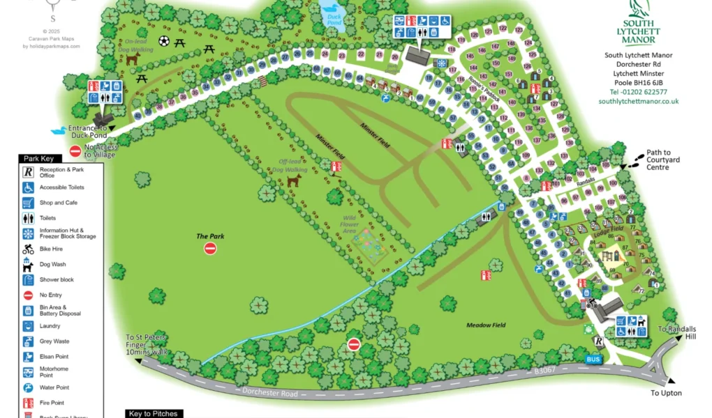
The South Lytchett Manor Caravan and Camping Park Map showcases an expansive 25-acre parkland layout, meticulously organized to offer both luxury and a connection to the Dorset countryside. Centered around the historic Manor house grounds, the map highlights a diverse range of accommodation zones. The premium Superior and Deluxe pitches are strategically placed for maximum space, while the charming glamping village—home to Romany Caravans and Shepherd’s Huts—is tucked into a beautifully landscaped corner for added privacy.
For those navigating the site, the map clearly identifies three award-winning amenity blocks, renowned for their high standards and cleanliness. Key social hubs, including the Courtyard Shop and the on-site café, are centrally located near the main entrance for easy access upon arrival. Families can easily locate the adventure playground, while pet owners will appreciate the dedicated 2.5-acre off-lead dog exercise meadow and professional dog wash station. With clear indicators for the bus link to Poole and the surrounding cycling network, this map serves as an essential guide for exploring both the park’s top-tier facilities and the nearby Jurassic Coast.