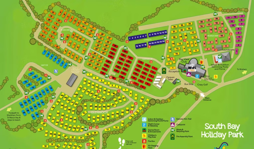
South Bay Holiday Park Map
Holiday Park Maps Maps

South Bay Holiday Park Map

πŸ–οΈ Exploring South Bay Holiday Park

The South Bay Holiday Park Map is an essential guide for exploring this lively resort overlooking Brixham Harbour. It clearly shows the layout of the park, helping you easily locate your accommodation and find your way to the various facilities on offer.

The map highlights the park’s main leisure facilities, including the indoor and outdoor heated pools, adventure playground, and amusement arcade. It also features the Bay View Club for live entertainment.

For your convenience, essential services like the shop, launderette, and reception are clearly marked. You can also easily find the footpath leading directly to St Mary’s Bay, providing quick access to the beach.

πŸ“₯ Download South Bay Map
Verified Map
Current Version:

πŸ—ΊοΈ Interactive Map Location

Use our interactive map to explore South Bay Holiday Park from different angles. Switch to Satellite for a clear view of the park layout, Map for navigation, or use Street View to get a feel for the park entrance and surrounding coastal area before you visit.