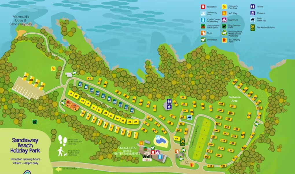
Sandaway Beach Holiday Park Map
Holiday Park Maps Maps

Sandaway Beach Holiday Park Map

🏑 Exploring Sandaway Beach Holiday Park

The map of Sandaway Beach Holiday Park reveals its unique clifftop location, boasting spectacular sea views. It clearly outlines the various accommodation types, including caravans, chalets, and apartments, with some indicating their prime positions for coastal vistas. A key feature on the map is the path leading directly down to Mermaid’s Cove, the park’s private beach perfect for rock pooling.

Facilities & Entertainment: You’ll also locate the Smuggler’s Bar, a social hub, often with outdoor seating to enjoy the scenery. Essential amenities like the outdoor heated swimming pool and children’s play areas will be marked.

Accessibility & Location: Given its hilly terrain, the map may include advisories about accessibility. It further highlights its close proximity to the village of Combe Martin, offering easy access to local amenities and attractions.

Verified Map
Current Version:

πŸ—ΊοΈ Interactive Map Location

Discover the unique clifftop setting of Sandaway Beach Holiday Park with our interactive map. Switch between high-resolution satellite views to see the coastline, standard map mode for navigating accommodation and facilities, or immersive street view to preview the park grounds and the path leading down to the private Mermaid’s Cove beach. This guide helps you easily locate your chosen accommodation and plan your stay in beautiful North Devon.