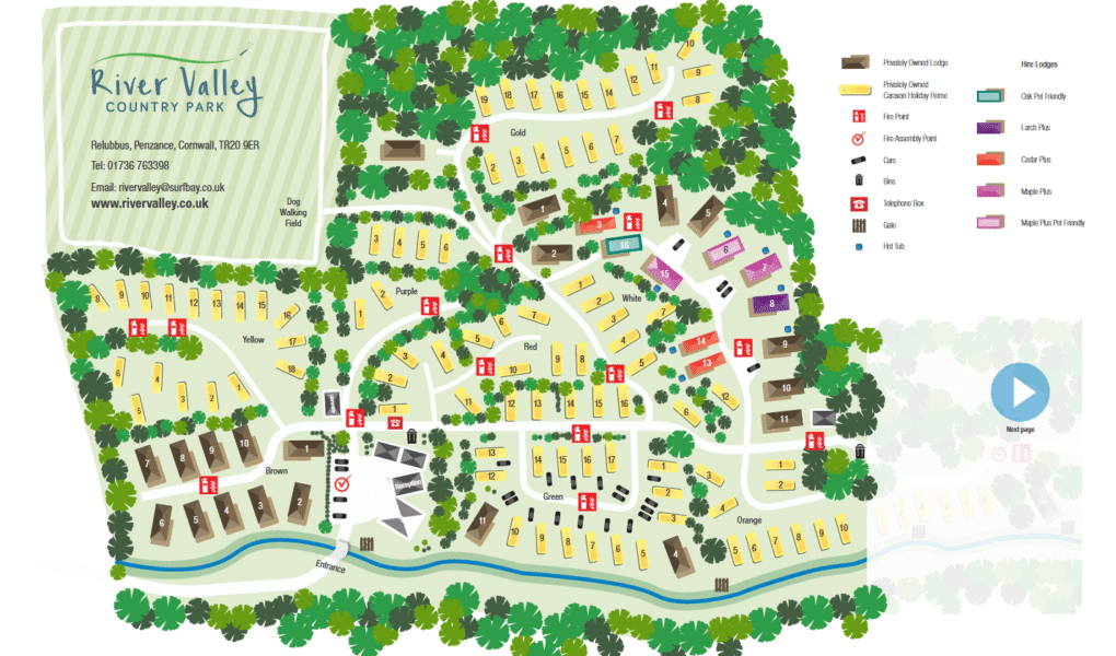
River Valley Country Park Map
Holiday Park Maps Maps

River Valley Country Park Map

The River Valley Country Park map provides a detailed and easy-to-read layout of the site, helping guests quickly locate key areas and accommodations. It highlights various types of stays, including Privately Owned Lodges and Caravan Holiday Homes. The map clearly marks essential safety features such as Fire Points and Fire Assembly Points. Guests will find designated areas like Cedar Plus, Larch Plus, and Maple Plus, with some pet-friendly options clearly noted.

Bins and the Telephone Box are conveniently placed for guest use. Cars Oak and Maple Plus Pet Friendly areas are ideal for visitors with pets. Additional amenities like the Hot Tub area and the park’s main Gate are also marked for convenience. Whether you’re staying short-term or own a lodge, the map ensures a smooth and organized stay at the park.


River Valley Country Park Google Map

River Valley Country Park is easily accessible on Google Maps, providing clear directions and an overview of the park’s location. Visitors can explore the layout, nearby roads, and local amenities before arrival. Google Maps offers satellite and street views, helping guests familiarize themselves with the park’s surroundings. It also shows nearby attractions and facilities, making it simple to plan trips and navigate within the area. This tool enhances convenience and confidence for visitors heading to River Valley Country Park.