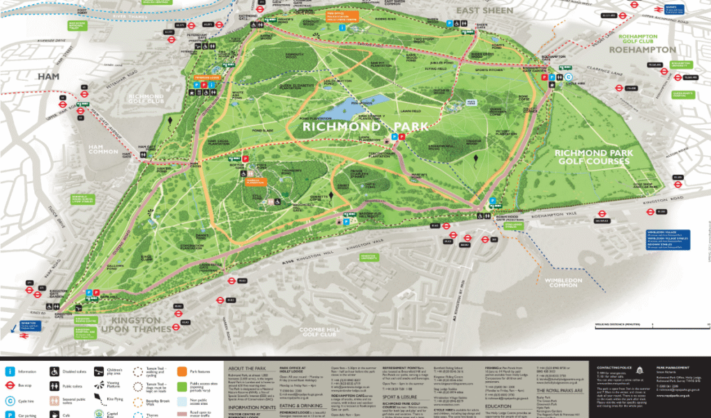
Google Map
Richmond Park Google Map provides an interactive way to explore London’s largest Royal Park. It highlights key locations like the famous deer herds, walking trails, cycle paths, and scenic viewpoints such as Pen Ponds. The map also shows essential amenities including public and disabled toilets, cafés, visitor centres, and parking areas. Users can switch between satellite, terrain, and street views to get a detailed perspective. Whether planning a visit or navigating within the park, Richmond Park Google Map is a helpful tool for all visitors.