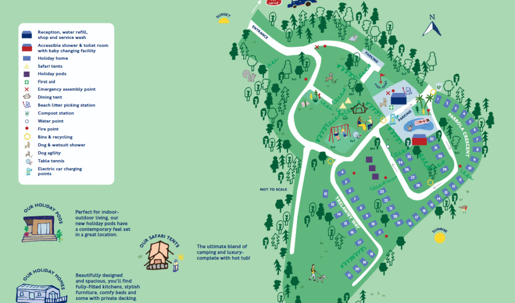
Parbola Holiday Park Map
Holiday Park Maps Maps

Parbola Holiday Park Map

The Parbola Holiday Park Map offers a clear and organized layout of the park’s key amenities and services. Upon arrival, guests can find the reception area along with a shop, service wash, and water refill point. The map also highlights accessible shower and toilet facilities with a baby changing room, catering to families and individuals with additional needs. Accommodation options such as holiday homes, safari tents, and holiday pods are clearly marked for easy navigation throughout the park.

For comfort and safety, the map shows essential features like a first aid point, fire points, and an emergency assembly area. Environmental facilities include a compost station, recycling bins, and a beach litter picking station. Guests travelling with pets can use the dog and wetsuit shower or enjoy the dog agility course. Recreational areas such as the dining tent and table tennis table are also conveniently indicated.


Parbola Holiday Park Google Map

Parbola Holiday Park is clearly visible on Google Maps in Street View, Satellite, and Standard map formats. The Satellite view reveals the lush surroundings and spacious layout of the park, while Street View lets you explore the nearby roads and entrance before arriving. The Standard map offers useful road names, markers, and directions to navigate the area with ease. Together, these views help guests plan their route and get a feel for the park’s environment.