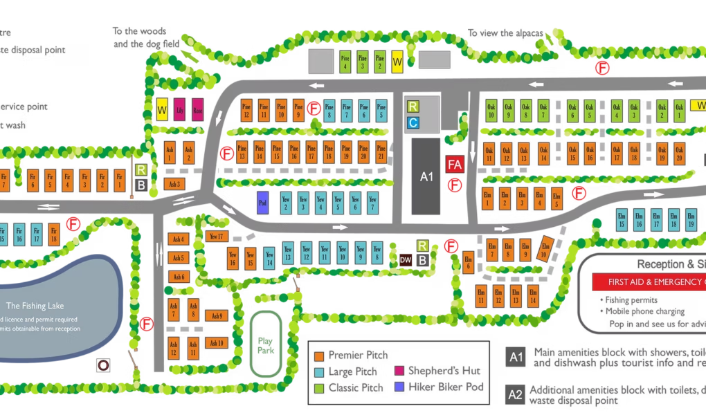
Newberry Valley Park offers a thoughtfully designed site map that highlights all key facilities and accommodation types to help you plan your stay with ease. The hiker biker pod is perfect for solo adventurers or cyclists needing a restful stop. For a unique glamping experience, the shepherd’s hut provides cosy charm and comfort. Spacious large pitches and premier pitches cater to caravans, campervans, and tents, offering excellent views and convenience.
The on-site fishing lake is a peaceful spot for anglers, while the secure dog field allows your pets to run freely. Site wardens are always on hand to assist and ensure a smooth stay. Practical amenities like the dog and wetsuit wash station help keep both pups and gear clean after coastal adventures or muddy walks.
Newberry Valley Park Google Map
On Google Maps, Newberry Valley Park appears as a peaceful, well-maintained site nestled in a lush North Devon valley. The standard map view clearly outlines the layout, including the fishing lake and spacious pitches. The satellite view reveals the site’s green surroundings, woodland edges, and proximity to the coast. Street view offers a realistic perspective of the entrance, tree-lined driveway, and countryside charm, helping visitors visualise their stay before arrival. It’s a truly scenic and welcoming location.