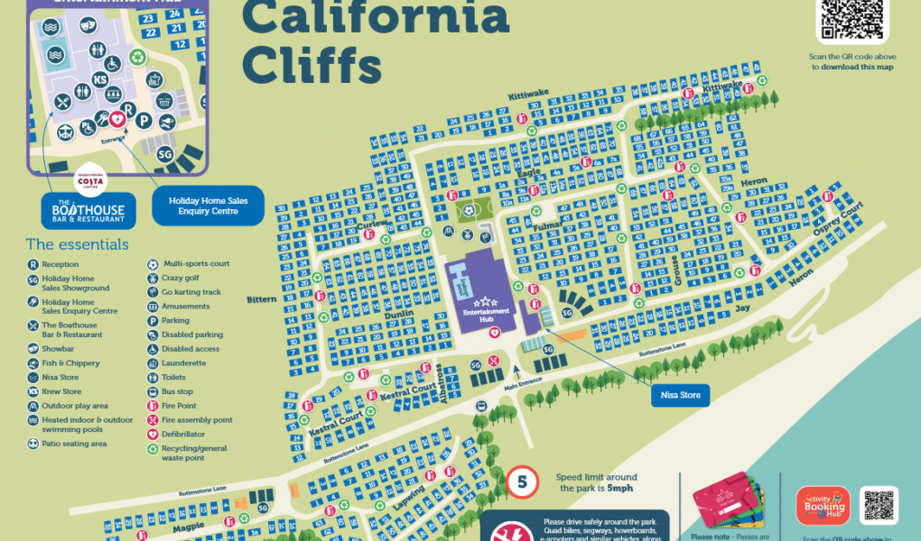
California Cliffs Holiday Park Map
Holiday Park Maps Maps

Naze Marine Holiday Park Map

πŸ–οΈ Exploring Naze Marine Holiday Park

The Naze Marine Holiday Park map is your essential navigator for exploring this fully refurbished Walton-on-the-Naze resort. It highlights everything from high-energy activity hubs near the entrance to quiet accommodation villages and pedestrian paths leading out to the famous Essex coast.

Use the map to pinpoint major resort upgrades including the indoor Sports Dome (laser quest, archery), the heated indoor pool with a toddler splash zone, and the Arts & Crafts Den. It also directs you to dining hotspots like The Boathouse Bar & Restaurant, the Pizza Box, and the Naze on the Rocks horse-box bar.

Top Tip: This area is a fossil hunter’s paradise! Follow the mapped coastal trails towards the nearby Naze Nature Discovery Centre and the Red Crag Cliffs, where you can search for prehistoric shark teeth along the shoreline at low tide.

Verified Map
Current Version:

πŸ—ΊοΈ How to Navigate the Interactive Map

πŸ›°οΈ

Toggle Map Views: Switch to Satellite View to clearly look over the entire layout of the caravan sectors and premium lodge zones, or use the Standard Map to track vehicle routes, main facility areas, and walking paths.

🚢

Explore Street View: While Street View does not enter inside the private holiday park itself, you can use it on Hall Lane right outside the main entrance to preview the approach road, primary guest reception area, and the start of the coastal trail heading out toward the Naze Tower cliffs.

Interactive Map