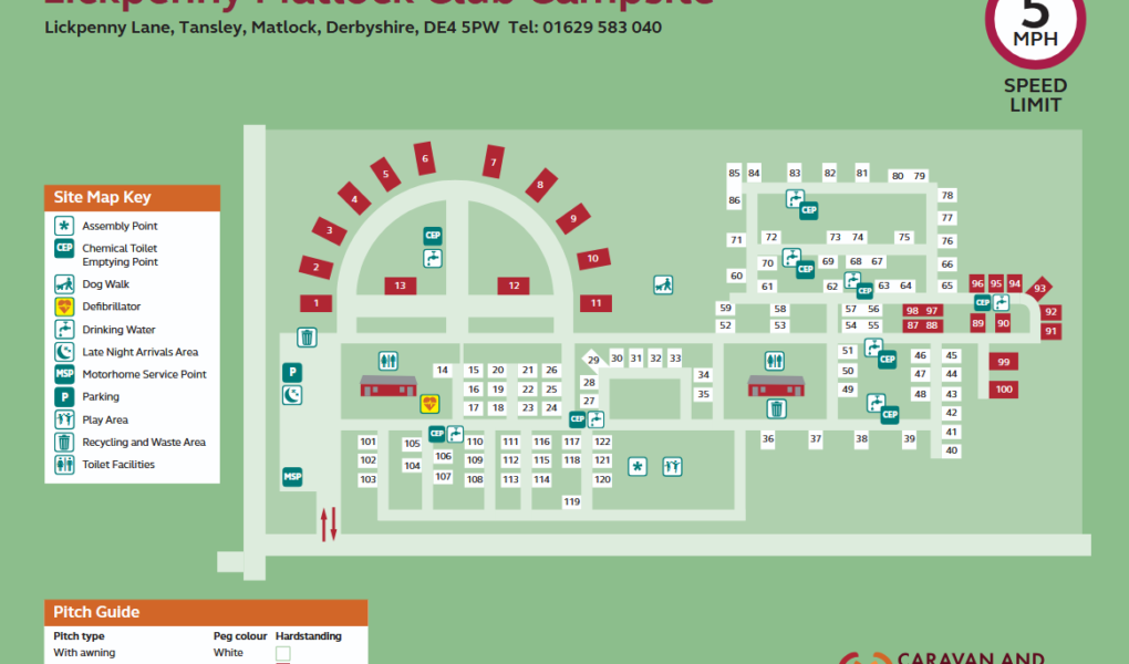
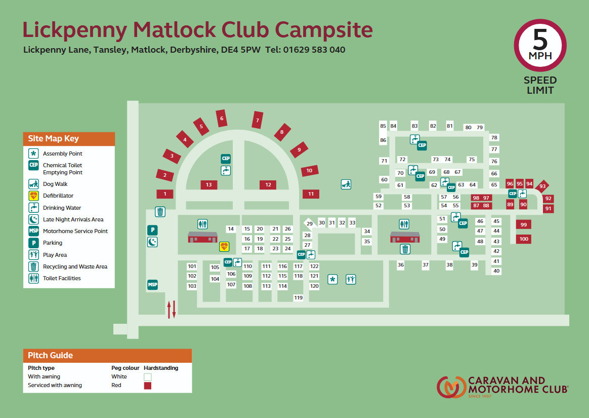
The Lickpenny Caravan Park Site Map (now officially known as Lickpenny Matlock Club Campsite) highlights a tranquil 16-acre retreat set on a former nursery in the heart of the Derbyshire Dales. The layout is masterfully integrated with the natural landscape, featuring over 120 generous hardstanding pitches bordered by mature trees and vibrant rhododendrons. The map clearly distinguishes between standard pitches and the extra-large deluxe serviced pitches, which offer individual water and drainage connections, all thoughtfully tiered to provide far-reaching views across the hills toward the historic Riber Castle.
As the site plan illustrates, the park is designed for total convenience with two centrally heated, high-specification amenity blocks serving as the primary hubs. The map also pinpoints key family and pet-friendly features, including a centrally located children’s playground and a dedicated woodland dog walk that meanders through the estate. For those looking to venture out, the map shows the site’s proximity to Matlock and Bakewell, as well as the nearby walking route to the local garden centre and cafe. Whether you’re navigating toward the EV charging points or seeking a quiet corner near the meadows, this map is an essential guide for exploring one of Derbyshire’s most scenic 5-star touring destinations.