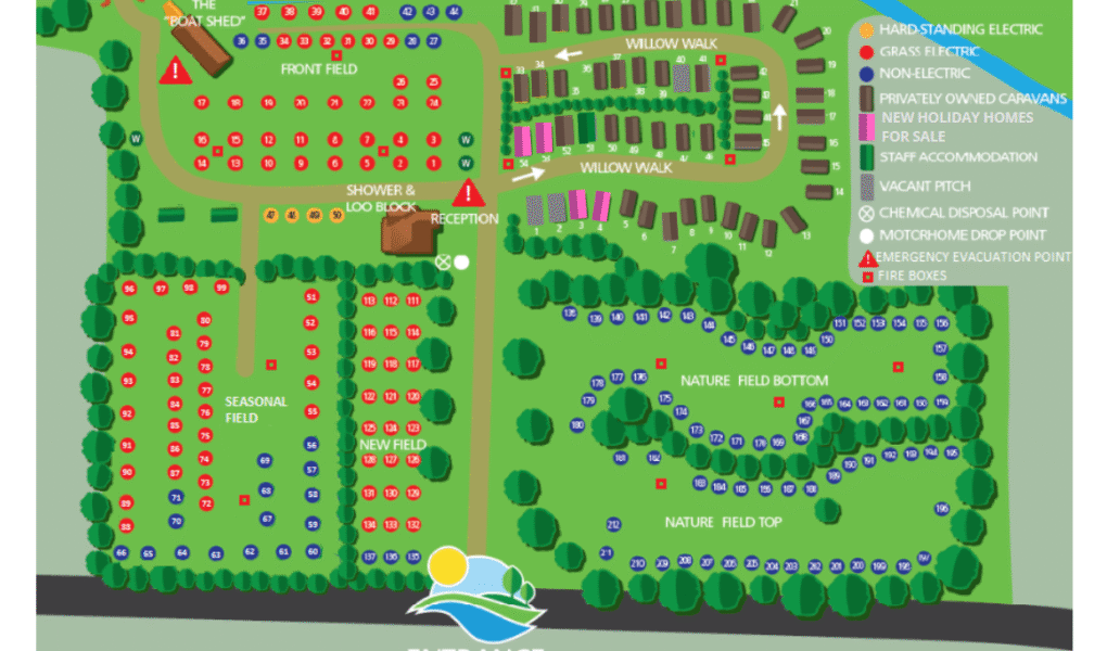
Hardwick Park Holiday Park Map
Holiday Park Maps Maps

Hardwick Park Holiday Park Map

The Hardwick Park Holiday Park Map clearly outlines the layout of the park, making it easy for visitors to find essential facilities. Fire boxes are strategically placed throughout the park to ensure safety in case of emergencies. The map also marks the emergency evacuation point, providing a designated safe area for all guests to gather if needed. For motorhome travelers, there is a convenient motorhome drop point and a chemical disposal point to maintain cleanliness and comfort.

The map further distinguishes different types of pitches, including vacant pitches, non-electric pitches, and grass pitches with electric hookups. Staff accommodation areas are also identified, separating visitor zones from staff living spaces. This detailed map helps guests navigate the park efficiently, ensuring a safe and enjoyable holiday experience for everyone.


Hardwick Park Holiday Park Google Map

Hardwick Park Holiday Park on Google Maps offers clear views through satellite, standard, and street modes. The satellite view reveals the park’s lush green surroundings and layout of pitches and facilities. The standard map provides easy navigation with marked roads and amenities. Street View lets visitors virtually explore pathways and entrances, giving a real-life feel of the site. Together, these views help users plan their visit and understand the park’s layout before arrival.