
Google Street Map
Blackpool Zoo is visible on Google Street View, but it primarily offers views of the surrounding area rather than internal pathways or animal enclosures. You can explore the zoo’s location from the outside, giving you a glimpse of the entrance and nearby roads.
Google Satellite Map
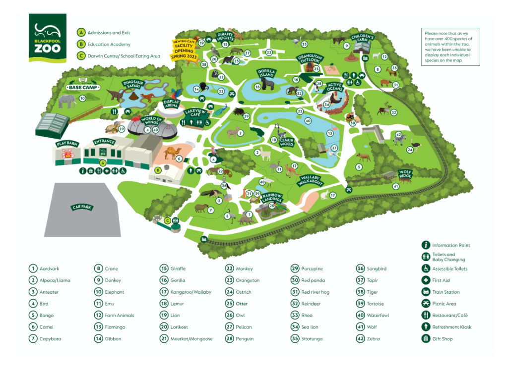
Blackpool Zoo’s satellite map offers a detailed overhead view of the zoo’s layout, showcasing its 32-acre space. Key areas like Gorilla Mountain, Dinosaur Safari, and Penguin Beach are clearly marked. The map helps visitors plan their route, ensuring they can easily navigate the zoo’s various attractions, ensuring an efficient and enjoyable visit.
Google Map
Blackpool Zoo’s Google Map offers a clear, interactive view of the zoo’s layout. Visitors can zoom in on different sections of the zoo, locating entrances, pathways, and key exhibits. The map makes it easier to navigate the grounds, find amenities like cafes, and plan a visit, ensuring an efficient and enjoyable experience throughout the zoo.