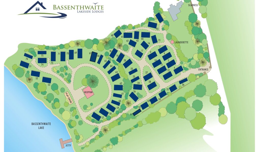
Bassenthwaite Lakeside Lodges Map
Holiday Park Maps Maps

Bassenthwaite Lakeside Lodges Map

The Bassenthwaite Lakeside Lodges map highlights the beautiful lakeside location and key features of this peaceful holiday park. The map shows individual lodges nestled among trees, offering stunning views of Bassenthwaite Lake. Important amenities marked include the reception area, parking spaces, and waste disposal points. Walking trails leading to the lakeshore are clearly indicated, along with picnic areas for guests to enjoy the natural surroundings.

The map also highlights nearby facilities such as toilets and disabled access points, ensuring comfort for all visitors. Whether exploring the scenic routes or relaxing by the water, the map provides a helpful guide to navigate the lodges and make the most of the tranquil environment at Bassenthwaite Lakeside Lodges.


Google Map

Bassenthwaite Lakeside Lodges on Google Maps offers a clear and convenient view of this scenic retreat in the Lake District. The map pinpoints the lodges’ peaceful location near the shores of Bassenthwaite Lake, surrounded by lush woodland and serene landscapes. Satellite, standard, and street views allow visitors to explore the site layout, nearby walking trails, and access routes. It’s a useful tool for planning your journey and getting a feel for the natural beauty that awaits.