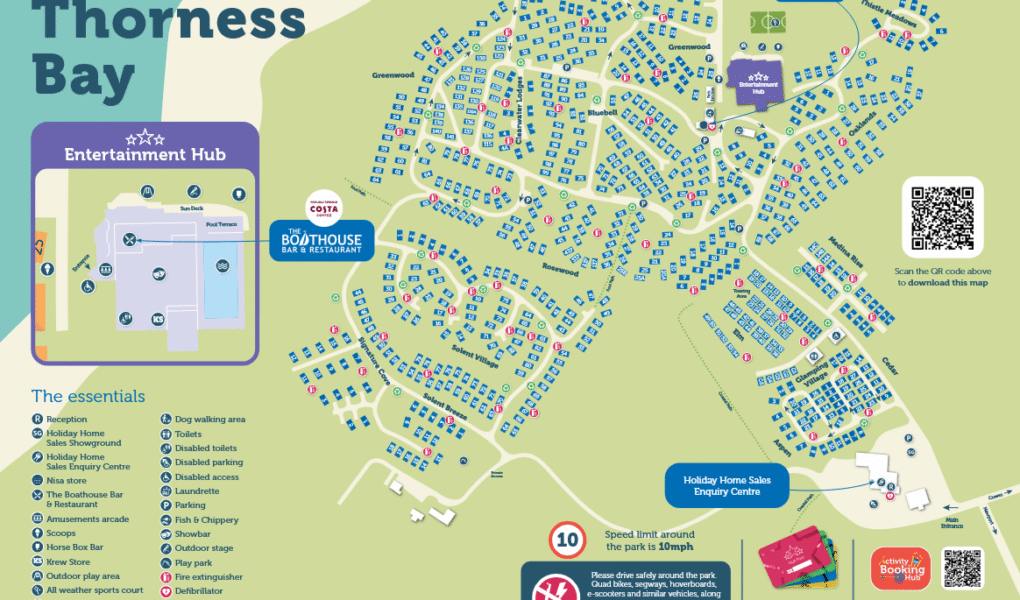
Thorness Bay Holiday Park Map
Holiday Park Maps Maps

Thorness Bay Holiday Park Map

πŸ–οΈ Exploring Parkdean Resorts Thorness Bay

The Thorness Bay Holiday Park map is your essential guide to navigating this unique countryside retreat on the Isle of Wight’s northern coast. Set on a sprawling woodland hillside, the layout helps you find your way from the premium cliff-top lodges down to the secluded beach.

Use the map to find main complex venues like the indoor fun pool with its water flume, the Regatta View Showbar, and the Boathouse Bar & Restaurant, which features an outdoor terrace with panoramic views across the Solent. It also highlights the on-site Fish & Chippery and Nisa store.

Activities & Coastal Paths: The map outlines dedicated zones for Hover Archery, the multi-sports court, and safari glamping tents. At the park boundary, you can easily connect directly to the famous Isle of Wight Coastal Path heading toward Cowes or Yarmouth.

Top Tip: Look out for the direct, leafy footpath on the map that guides you down to the beach. This sandy and shingle bay is a protected nature area, making it perfect for quiet coastal walks, rockpooling, and spotting local wildlife.

Verified Map
Current Version:

πŸ—ΊοΈ How to Navigate the Interactive Map

πŸ›°οΈ

Toggle Map Views: Switch to Satellite View to see the woodland hillside layout, individual caravan pitches, and premium cliff-top lodges, or use the Standard Map to easily trace roads and facility zones.

🚢

Explore Street View: Preview the main park entrance approach and surrounding holiday park lanes to get familiar with the arrival route before you set off on your journey.

Interactive Map