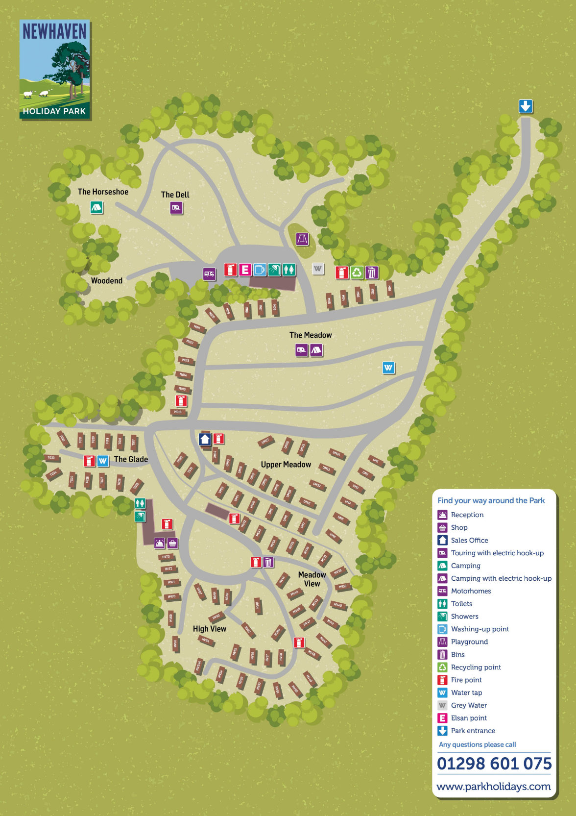
Newhaven Holiday Park Map
Holiday Park Maps Maps

Newhaven Holiday Park Map

Make sure to check this Newhaven Holiday Park Map before you arrive at the junction of the A515 and A5012 in Derbyshire. The site is split into areas like “The Glade” and “Meadow View,” with about 85 touring pitches tucked among the trees. If you’re towing a caravan, you’ll want to spot your hardstanding pitch on the layout early, as the grounds can be a bit sloping in places.

The main facilities are grouped together near the entrance, including the reception and a small mini-mart shop (it’s basically a well-stocked shed). There are two play areas for the kids and a couple of heated shower blocks that are easy to find on the map. Just a heads-up: it’s a cashless site now, and if you’re planning to hit the Tissington or High Peak Trails, the map shows the best exit points to reach them—they’re both less than a mile away.

✓ Latest Map Current Version:

Navigate Newhaven Holiday Park with Google Maps

Use the buttons below the map to toggle between Satellite View to see the sheltered, tree-lined layout of the tiered grounds, or Standard Map for a clear view of the site loops and the A515/A5012 junction. You can also use Street View at the park entrance to get familiar with the Peak District approach before you arrive, making it easier to find your way to the touring pitches, the onsite mini-mart, or the scenic trails leading toward the High Peak Trail and Dovedale.