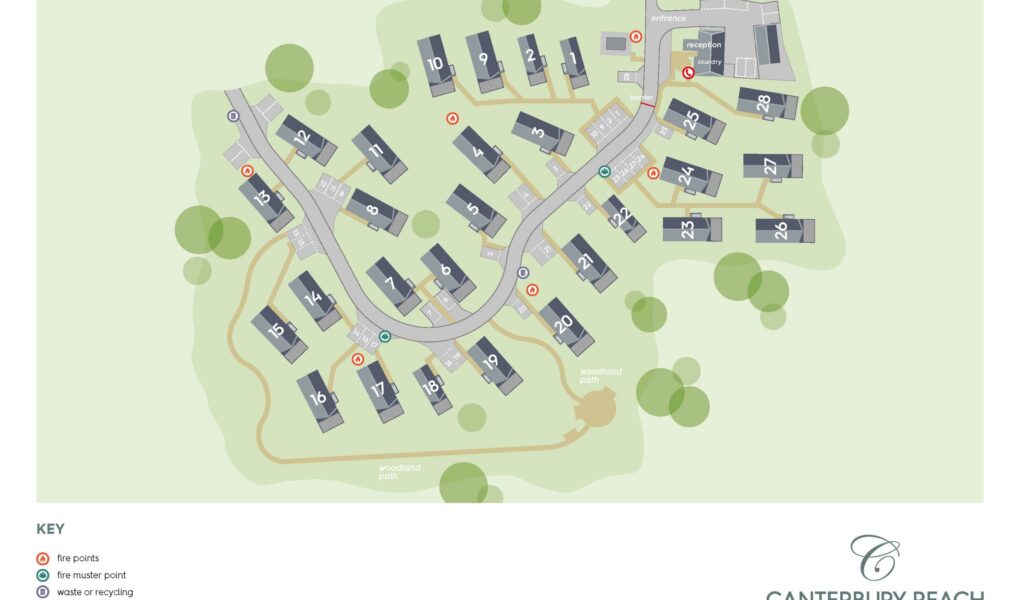
Canterbury Reach Lodge Retreat Site Map
Holiday Park Maps Maps

Canterbury Reach Lodge Retreat Site Map

Canterbury Reach Lodge Retreat site map offers guests a clear layout of this beautiful countryside escape nestled in Kent. The site is thoughtfully arranged, showcasing the positions of luxurious holiday lodges, visitor parking bays, reception area, and landscaped communal spaces. Internal roads wind gently through the retreat, offering easy access to each lodge while maintaining a peaceful ambiance.

The site map also highlights key points such as the entrance gate, refuse points, and designated walking paths ideal for guests with dogs. Surrounded by natural beauty, the map reflects how lodges are strategically placed to maximize privacy and views. Whether you’re planning your arrival, locating amenities, or simply exploring the grounds, the Canterbury Reach site map is an essential guide to a relaxed and well-organised stay.


Canterbury Reach Lodge Retreat Site Google Map

Canterbury Reach Lodge Retreat can be easily explored on Google Maps using standard, street, and satellite views. The standard map view offers a clear layout of roads and the surrounding countryside, ideal for planning routes. Street View lets users virtually explore the area and entrance to the retreat. Satellite view provides a detailed aerial perspective, showcasing the park’s layout, lodges, and its beautiful natural surroundings near the historic city of Canterbury.