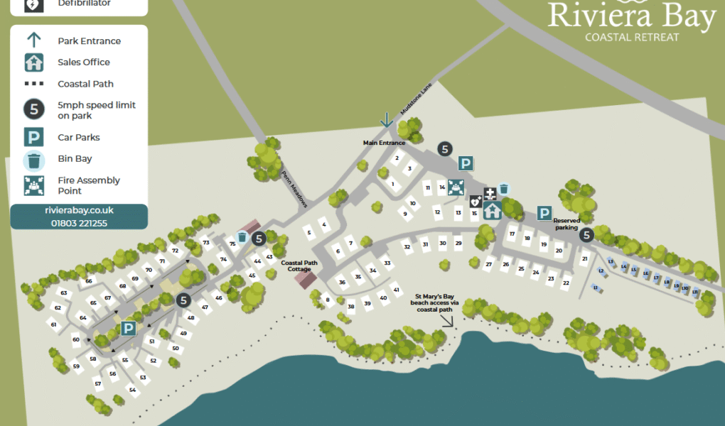
Riviera Bay Holiday Park Map
Holiday Park Maps Maps

Riviera Bay Holiday Park Map

🌊 Exploring Riviera Bay Holiday Park

The Riviera Bay Holiday Park Map is designed to help you easily find your way around the resort. Whether you are arriving for the first time or looking for the nearest car park, this map shows you exactly where to go, including the main entrance and the sales office where you can find guest support.

To keep everyone safe, please note the park-wide 5mph speed limit. The map also helps you locate essential services like the bin bays to keep our park clean, and it clearly marks the designated fire assembly point so you know exactly where to gather in an emergency.

If you enjoy being outdoors, the map highlights the nearby Coastal Path, providing easy access to beautiful walking routes right on our doorstep.

πŸ“₯ Download Riviera Bay Map
Verified Map
Current Version:

πŸ—ΊοΈ Interactive Map Location

Explore Riviera Bay Holiday Park from multiple perspectives. Use the Satellite view for a bird’s-eye look at the park’s layout, switch to Map for a clear structural plan, or dive into Street View to preview paths and facilities before you arrive.