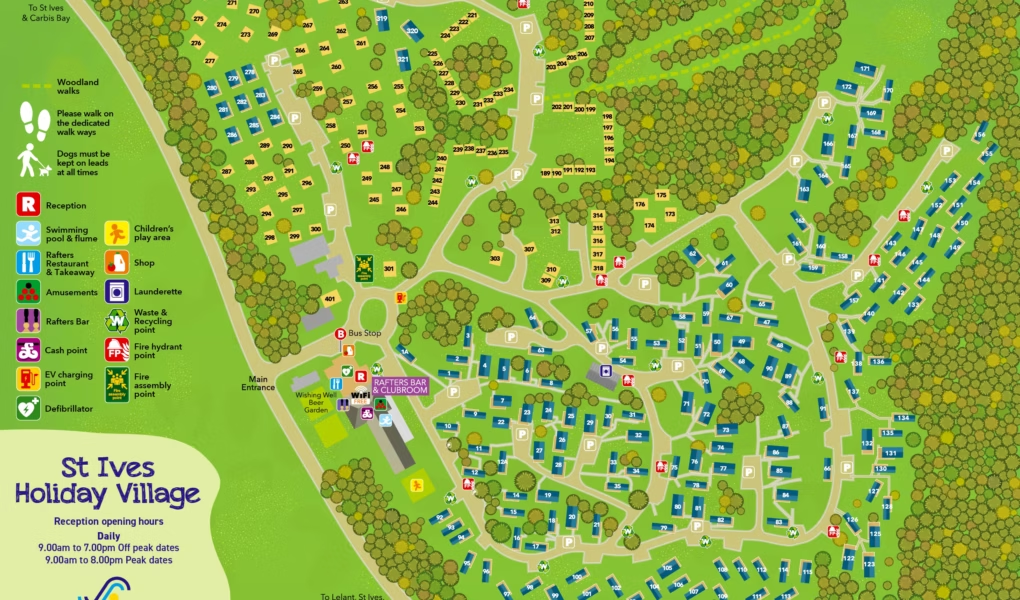
St Ives Holiday Village Map
Holiday Park Maps Maps

St Ives Holiday Village Map

🌲 Exploring St Ives Holiday Village

The St Ives Holiday Village Map is your essential navigator for this sprawling 100-acre woodland retreat in Lelant. Use it to explore the park’s unique terrain, from secluded accommodation glades to the central hub of high-energy facilities like the Aquatic Suite. It also helps you identify key transit links, including the St Ives bus shuttle at the park entrance.

Facilities: Locate The Rafters Club for evening entertainment, the indoor swimming complex, and dining options like Chefs Corner. The map also directs you to the arcade, crazy golf, and on-site mini-market.

Useful Tips: Use the map to identify Monta-network EV charging points and dog-friendly walking zones. Top Tip: Visit the picnic areas away from the main buildings at nightβ€”the forest canopy offers incredible “Dark Sky” stargazing.

Verified Map
Current Version:

πŸ—ΊοΈInteractive Map Location

The St Ives Holiday Village interactive map tool offers three distinct perspectives to help you explore. Use the standard normal view to scan clear street layouts, highways, and structural outlines easily. Switch over to the high-resolution satellite view to examine detailed real-world terrain, lush green spaces, and actual building footprints from above. Finally, activate the immersive street view mode to experience a realistic ground-level perspective, allowing you to virtually walk around and view the surroundings firsthand.